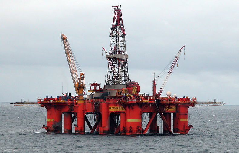
Not long ago, petroleum was starting to seem like an outdated source for fuel, as global reserves diminished and concerns about climate change pushed the focus to alternatives. But with 2013 oil prices topping $100 per barrel, and reservoirs around the world confirming new discoveries every year, oil remains both available and profitable — despite the increasingly extreme technological lengths oil companies are undertaking to recover it.
Now, research out of Stanford University could give oil companies an even greater upper hand by improving recovery techniques and letting drillers more effectively monitor existing fields in the North Sea.
Imagine an oil field like you would imagine a balloon filled up with air. If you were to stick a pin in the balloon, all the pressure from inside would send that air streaming out. Similarly, a well extracts oil by puncturing the subsurface. The resulting pressure imbalance squeezes the oil, just like the air in the balloon, up the well through tiny pores that act like pipelines. The downside is that sometimes the pressure from layers upon layers of sediment can completely close off fractures in the rock, and drillers have little way of predicting such a setback with active seismic tests commonly used today.
“Many fields worldwide have shown problems in the overburden,” or their ability to withstand the pressure compressing an oil reservoir, says Sascha Bussat, a Norwegain researcher for the energy company Statoil. At best, active seismic surveys can only gather information every six months. Boats must float out into the great, stormy, maritime expanse with guns full of compressed air, which blast sound miles deep into the seabed. By measuring the time it takes for the vibrations to reach the subsurface and bounce back to detectors on the ship, surveyors can estimate the best places to search for oil and monitor the effectiveness of drilling.
The costs of these tests runs into the tens or even hundreds of millions of dollars, and it takes years of data analysis before companies can determine the best drilling prospects.
But Sjoerd de Ridder, a Stanford University geophysics graduates student investigating oil extraction in the Norwegian corridor of the North Sea, aims to bridge the data disconnect presented by big-ticket, active seismic testing by offering a more affordable model. At the annual School of Earth Sciences Research Review in April, de Ridder explained that offshore platforms in Norway’s Valhall Field can continuously record fainter seismic waves naturally occurring at the ocean floor as water moves along the crust of the earth.
Notably for oil companies, according to de Ridder, these passive, or ambient seismic tests could better pinpoint where and when expensive surveys should optimally be used. The value of de Ridder’s ambient seismic approach lies in harvesting data in real time and for almost no additional cost above normal operations. “That makes any value equation good,” he says.
British Petroleum (BP), the operator of Valhall Field, has been moving to drive ambient seismic testing research forward. When de Ridder began diving further into mapping Valhall’s oil deposits in 2008, scientists had known about ambient seismology for decades, but they hadn’t yet applied it to monitoring oil reserves. De Ridder spent the last summer in Norway where initial tests proved successful, and he expects that, within a year, the proper infrastructure will be in place to monitor seismic signals in the North Sea 24/7.
As our energy requirements continue to outpace our abilities to harness alternative sources, de Ridder predicts that this virtually free information from ambient seismic technology will have an impact. “We’re headed for world where there’s still as much hydrocarbon exploration and exploitation as possible,” he says. In de Ridder’s eyes, that’s an industry that Norway can’t live without.
“Norway is definitely a country that floats on oil,” he notes. In 2009, the petroleum sector was responsible for 21 percent of Norway’s economy. Presently, however, the Norwegian government, which possesses drilling rights in the North Sea along with the Netherlands, Denmark, Germany, and Great Britain, is overrun with costly delays and declining productivity. Because oil companies can write off 78 percent of their losses on bad exploration or drilling investments, these obstacles are dealing direct blows to the country’s economic growth and welfare funding.
Still, oil discoveries are keeping Norway in the game. The resources in Norway’s 2012 finds amount to an estimated 58 percent of last year’s total production. It’s a significant stage to possibly debut ambient seismic tests, with great rewards to be reaped from better reservoir monitoring.
In an interview following the research seminar, de Ridder silently struggled to find a way to distill five years of research into one thought on the lasting impact of his work. He paused for almost 30 seconds before concluding: “The major achievement would be that I show that there is a wealth of information that can be retrieved form ambient seismic noise that could be of interest to the oil industry.” De Ridder continued, “There is a huge source of data out there that we’re not tapping into. That, I think, is key.”
